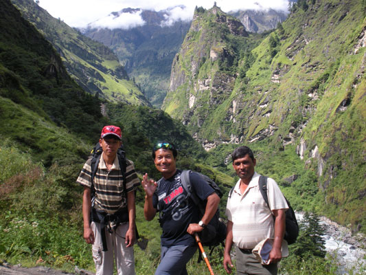
Today we began trekking. I am glad after spending yesterday sat on a bus. Before we left Besi Sahar I went to buy a sunhat and Kanchha bought some playing cards. With me on the trek is Kanchha, my guide, Roj, my porter and Jagadish who is a friend of Kanchha’s. Jagadish got the bus with us from Kathmandu yesterday and visited his sister in Besi Sahar last night.
Our walk took us along the Marsyangdi River. There were many rice fields and forested hills on the other side. These hills would probably be considered mountains in many parts of the world. Soon the sun came out and it became very hot and sweaty. I was glad I bought the sunhat in Besi Sahar.
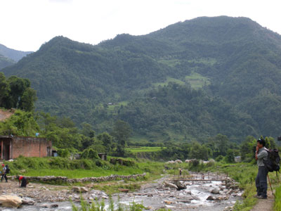
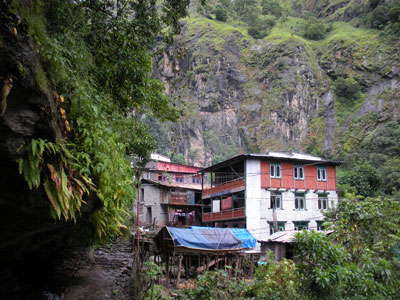
5.1. The beginning of the trek, Besi Sahar to Bhulbhule.
Along the walk Kanchha began my Nepali lessons. I am tested at irregular intervals along the trail. I am having a bit of trouble remembering but I think I am beginning to improve. The ACAP safe water drinking stations seem to be closed as it is not quite high season yet. I buy one last bottle of filtered water. After this I will be using Iodine to purify the water. At Khule we crossed a large suspension bridge and arrive at Bhulbhule. I order a noodle soup for lunch. It was like instant noodles but it was tasty and just what I needed after a long sweaty walk. The others have their Dal Bhat. After lunch I took a walk around Bhulbhule and took some photos. I met a Gurung villager who had previously served as a Ghurkha in the Indian army.
5.2. The walk to Ngadi.
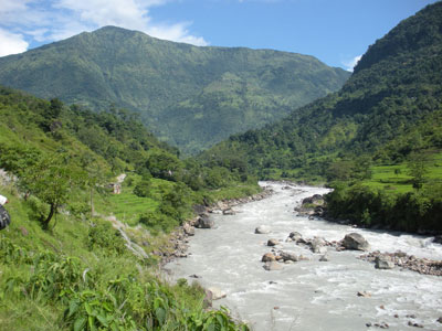
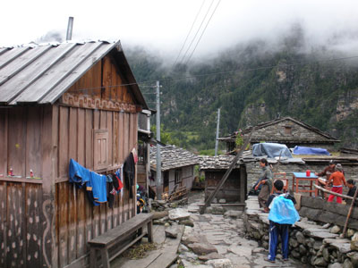
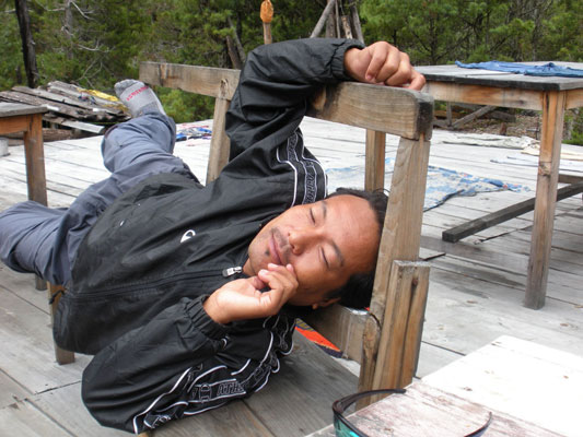
We soon headed off for the afternoons walk. We crossed another bend in the river and passed a spectacular waterfall. The path then cut through rice fields and it became very muddy. After about an hour and a half’s walk we arrived in Ngadi where we will spend the night. The lodge, The Pisang peak, is basic but nice and the four of us spent the afternoon in the garden drinking tea and playing snap. I tried to teach the guys switch but it is a bit difficult. I went for a walk with Roj along by the river and I took some photos. The force of the river is pretty amazing. At night a storm comes and the noise of the rain on the corrugated iron roof is incredible. Eventually I manage to get some sleep but it is still not a full night.
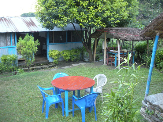
5.3. The lodge’s garden in Ngadi.
Day 6: Ngadi (930 m) to Jagat (1300 m)
The morning brings clear skies after the rain storms and with it views of Pisang peak (6090 m), hence the name of the lodge I suppose. We start walking and soon find ourselves climbing up a ridge on the east side of the Marsyangdi valley. Along the way we come across a 72 year old porter bearing a load of 40 kg. We eventually make the climb up to Bahundanda, which means Brahmin hill. Brahmin is the highest of the Hindu castes. We stop here for tea before descending again towards Ghermu.
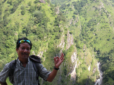
6.1. The walk to Bahundanda and Jagadish, Roj and Kanchha at tea break.
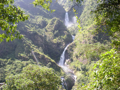
By the time we reach Ghermu I am very hot and tired and in need of a rest. The restaurant we choose has a great view of a huge waterfall on the other side of the Marsyangdi. After lunch we cross a suspension bridge and begin to climb high above the river. The path is steep and rocky so I am glad that it is in the shade. We eventually come to a ridge that is relatively flat and get our first views of Jagat perched precariously on the edge of a cliff. We reach the lodge and it seems quite modern compared to the others. My room is large and has en-suite bathroom and the most amazing view from the window. The ‘hills’ on the other side of the river are now very big with the river far below us. There is no electricity so I need to use my headlight to see anything. In the evening I had fried rice again (3 nights in a row now) and played snap with the others.
6.2. Ghermu waterfall and Kanchha above the gorge.
Day 7: Jagat (1300 m) to Dharapani (1900 m)
Last night again brought heavy rains but this time I got a good amount of sleep. The morning was grey and drizzly and I told Kanchha that this is what English weather is generally like. We climbed up the west side of the Marsyangdi valley out of Jagat. The path was rocky and very wet and we had to keep dodging leeches. Kanchha was bitten once but I was OK because of my thick heavy boots. Just outside of the village of Chamje we stopped for tea at the Kelson tea house.
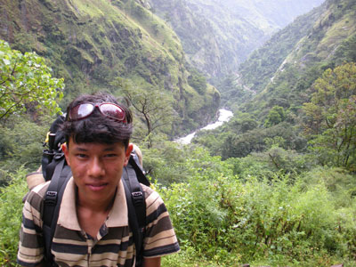
7.1. Roj on the walk to Chamje.
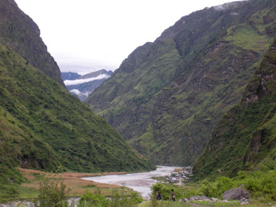
7.2. Tal: It’s not a lake but a flattish region where the river widens.
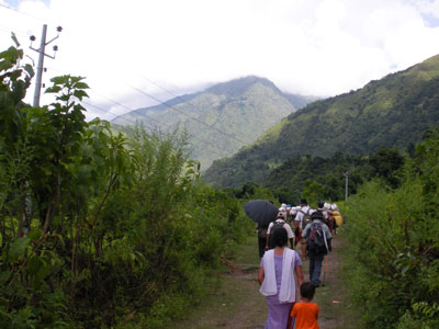
The path continued to climb up past fields of cannabis plants until we reached the hill overlooking Tal. Tal represents the border between Lamjung and Manang districts. The people in the Manang district also look different as well, more Tibetan rather than Indian. Coming into Manang district, I find that the safe water stations are now open. I didn’t get any in Tal as my bottle was already full. I’ll go tomorrow in Bagarchap. Tal is the Nepali word for lake; however Tal is not actually a lake but a flat region where the river widens.
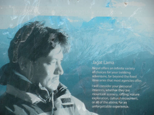
7.3. Jagat Lama is everywhere in the Annapurnas.
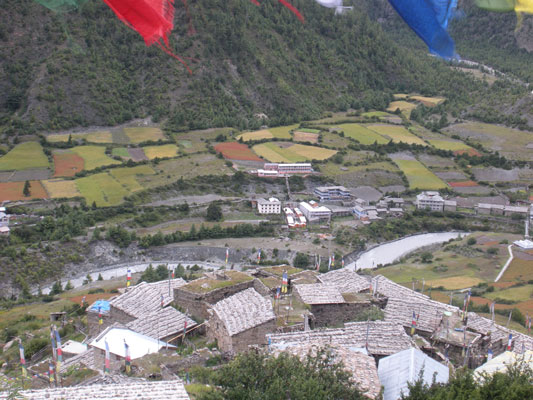
Leaving Tal we come to another part of the valley. At the end of the valley is a mountain (in my eyes). I ask Kanchha and he tells me that it is just a rock. We eventually pass through Karte and soon arrive at Dharapani, a village on the west of the river under the ‘just a rock’ mountain. We gained quite a bit of altitude today and it is distinctly cooler than the last few days. The lodge we chose is nice but not as nice as last night’s, although I do have a light in my room.
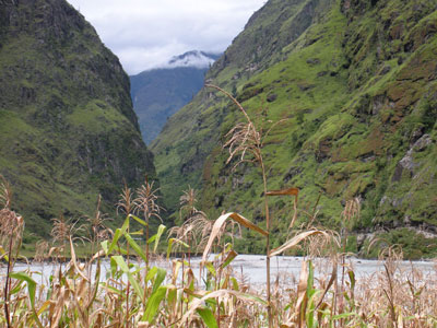
7.4. On the trail between Tal and Dharapani.
Day 8: Dharapani (1900 m) to Chame (2670 m)
The morning was wet and drizzly again and I wore my raincoat for the early part of the walk. The views across to the hills with the clouds sweeping across the pine trees were very impressive though. After about 30 minutes we arrived in Bagarchap but the safe water station was closed. We stopped at Danaque for tea and the water station here was open. The water tastes good and makes a nice break from the iodine. The climb up to Danaque was fairly easy even though we are now at 2300 m. After tea the climb was much harder and we eventually reach Tamang at 2500 m and I was glad of the rest here. It is now the highest I’ve ever been. It is colder as well and I will bring out my fleece jacket when we arrive in Chame.
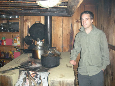
8.1. Clouds sweep across the hills near Dharapani (L). The lodge kitchen in Tamang (R).
The walk out from Tamang took us up a path high above the river. It was quite dizzying and the views here would have been spectacular were it not for the thick cloud that surrounded us. After going downhill and then steeply uphill we reached the picturesque village of Tanchok around which were fields of barley and corn. Soon afterwards we came to the village of Koto Qupar. In this village there is an ACAP checkpoint. When Kanchha went to get my permit checked he was almost knocked over by a pair of copulating dogs under the table. It was quite funny.
8.2. On the path towards Chame.
Soon afterwards we arrived at Chame. The prayer wall here was the longest I’d seen yet and Roj and I span all the prayer wheels. I rested for a bit in the afternoon and in the evening Kanchha and I went to an internet café. The internet was expensive here, 100 rupees a minute. I managed to email home but when I tried to log into Facebook it was far too slow. The weather had by this point taken a turn for the worst and was now raining heavily. I am looking forward to getting behind the mountains and into the shadow of the rain. In the evening Kanchha and I discussed the next few days trek. I wanted to do the high route from Pisang to Manang through the villages of Ngawal and Ghyeru as this route is well recommended. Unfortunately there is currently the possibility of landslides on this route due to the heavy rains.
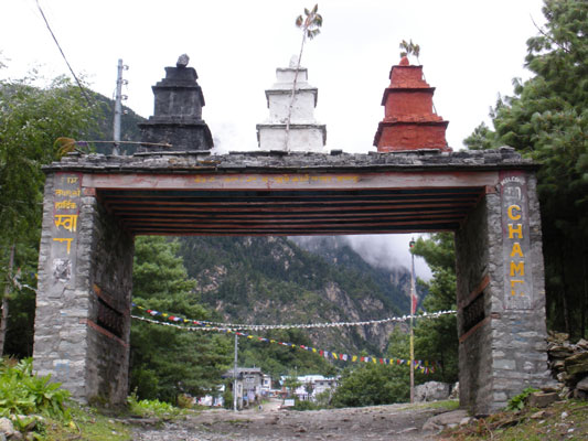
8.3. Welcome to Chame, administrative centre of Manang district.
Day 9: Chame (2670 m)
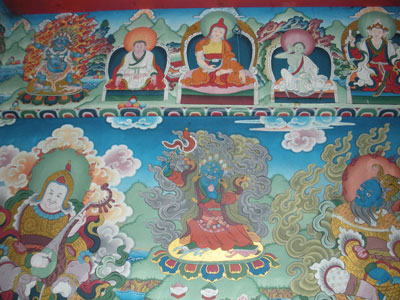
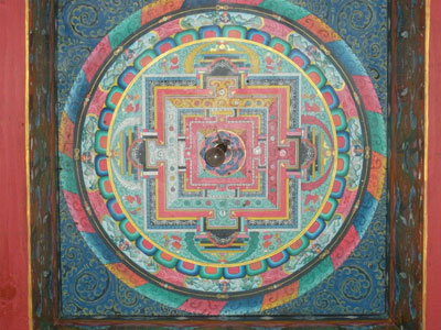
It doesn’t look like we’ll be able to leave Chame today. A huge storm came this morning at about 5:00 and it is still raining heavily. If it stops by lunch time we might be able to continue but it’s looking highly unlikely at the moment. I took a walk with Roj shortly after breakfast, waterproofed from the nose down. We came to a stupa with a beautifully painted interior, before deciding to head back.
9.1. Buddhist artworks in Chame stupa.
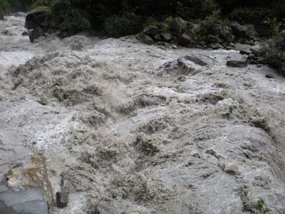
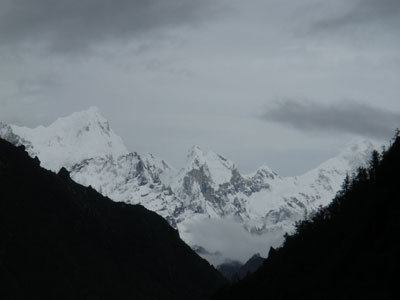
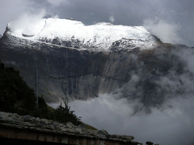
In the afternoon I went to the internet café to send some emails and charge my mp3 player. By this time the weather had cleared a bit and on my way back I met with Kanchha and we took a walk to the end of the village. This time we could just see Annapurna II through the clouds. We walked down to the hot springs next to the river which was incredibly rough from all the rain. When I got back there was the most incredible view of Manasalu Himal from my bedroom window. I took some photos for a while before deciding to go back to see if the view of Annapurna II had improved. It was a bit better but not as impressive as Manasalu. On the way back we met a couple of drunken Nepali men who wanted their photographs taken. I obliged and they were very happy and jolly and there was lots of handshaking. I went to the internet café again with Kanchha before returning to the lodge.
9.2. The swollen Marsyangdi (L). Manasalu Himal from the window of my room (R).
Day 10: Chame (2670 m) to Pisang (3180 m)
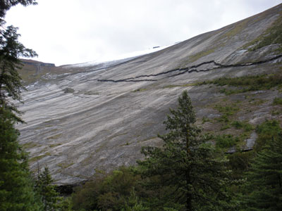
The weather was a bit better this morning and we were finally able to leave Chame. On the morning’s walk we had some slight views of Annapurna II, Lamjung Himal and Gangapurna. We stopped for morning tea in Bratang, which used to be a refugee settlement for Tibetans fleeing the Chinese invasion in the 1950’s. After Bratang, the path followed a route cut out of the side of the rock. Soon afterwards we came across Pangda Danda, a huge concave rock that is very smooth. It looks a bit like a giant skateboard ramp.
10.1. The paths can be treacherous.
We then walked uphill through a quiet coniferous forest before coming to Dhukur Pokhari where we stopped for lunch. We are now above 3000 m and I am feeling some of the effects of altitude. I am getting dehydrated more easily and walking is much harder, particularly uphill. I also feel a tiny bit dizzy, like being very mildly drunk. No headaches or sickness yet and hopefully that will continue. The clouds started to build before we finished lunch and the mountain views became obscured.
10.2. After a good lunch in Dhukur Pokhari.
10.3. Pangda Danda, the skateboard ramp rock.
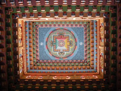
After lunch we came into the Manang valley, which is much wider than the valleys we have been in for the last few days. Coming into lower Pisang we could just glimpse Annapurna II through the clouds. We came to the lodge later in the afternoon and it was quite strange. All the rooms are in what look like garden sheds. Whilst sat in the dining room of the lodge a group of Israelis came in and demanded that they could recharge their camera batteries for free. The normal cost here is 100 rupees per hour. They were very rude and I am now beginning to see why the Nepali people despise the Israelis. In the afternoon we took a walk up to Upper Pisang, a predominantly Buddhist settlement. It was a stiff climb and I had to stop twice on the way up because of the altitude. It was a good idea to go up though, following the climb high, sleep low principle. At the very top of the village was the Pisang gompa. The walls and ceiling were all colorfully painted reminiscent of a small Buddhist Sistine chapel. In the evening I had rice again but with garlic soup as a first course. Garlic soup is often recommended for acclimatization. It was OK but I don’t think I would have ordered it otherwise.