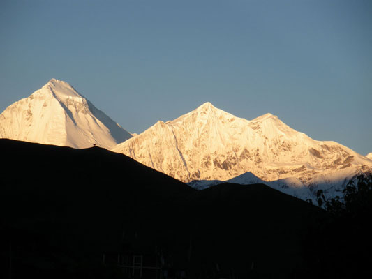
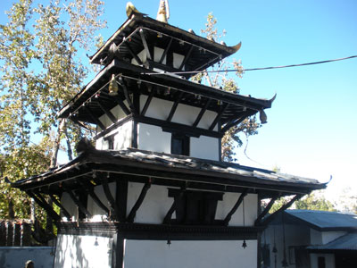
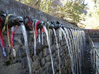
This morning I awoke at about 6:00 and went to watch the sun rise against Dhaulagiri and Tukuche peak. In the morning we went to the Muktinath temple complex. We visited the Hindu temple and then the Buddhist gompa, which has flames within from natural gas emitted by the rocks. After we left Muktinath we stopped by at the hotel in Ranipauwa to pick up our bags and then we walked to Jharkot.
16.1. Dhaulagiri and Tukuche peak in the sunrise.
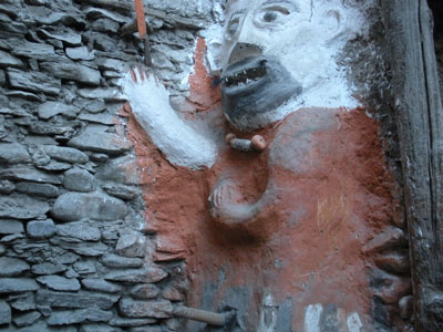
16.2. The Hindu temple and some of the 108 fountains at Muktinath.
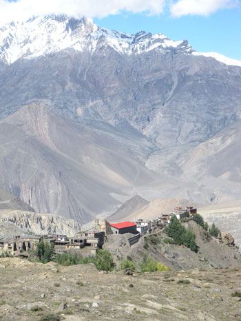
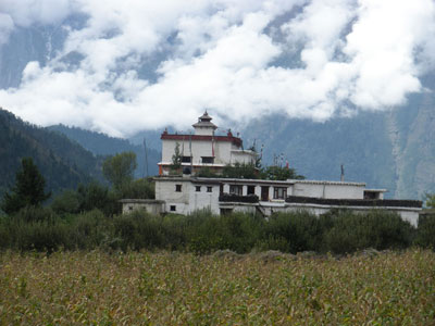
Jharkot is a small village on a ridge and it has a very medieval feel to it. We visited the gompa here before heading to Khingar where we stopped for lunch at The Blue Sheep guest house. The weather was very good today and it was getting hot in the afternoon. After lunch we started to descend towards Kagbeni. Later on the wind began to pick up. The Kali Gandaki is famous for the powerful wind that is caused by heating of the Tibetan plateau during the day. Luckily it wasn’t too dusty so it wasn’t too bad.
16.3. The descent to Jharkot and the view from Jharkot gompa.
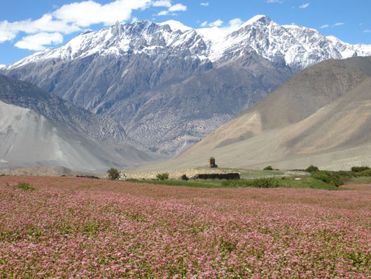
16.4. Buckwheat field near to Khingar.
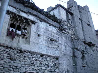
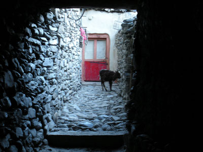
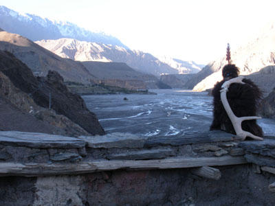
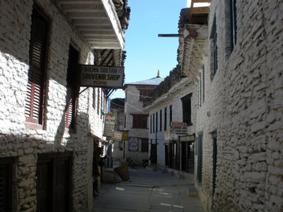
When we arrived at Kagbeni we stayed at The Shangri La lodge. It was a very nice lodge and the room had attached bathroom. I had my first hot shower since Dharapani. Feeling nice and clean, I went sightseeing around Kagbeni. Just outside the lodge a Tibetan woman introduced herself and asked me to look at her selection of Tibetan souvenirs. When I said that I was going sightseeing she made me promise to come back afterwards. Kagbeni is another village with a very medieval feel to it. It has small, narrow streets and has many calves and chickens walking along them. We came to the boundary with Upper Mustang that you need an additional permit to enter. We visited the local gompa and came back to the lodge. I kept my promise to the Tibetan woman and bought a few items from her including a necklace to replace the one from the Lama which I’d lost in Thorung Phedi. In the evening I had my first beer since Kathmandu and then Kanchha and I finished off the Marpha brandy.
16.5. Shots from around Kagbeni.
Day 17: Kagbeni (2800 m) to Jomsom (2710 m) to Marpha (2670 m)
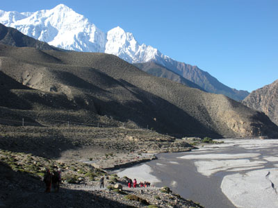
In the morning at breakfast I met a Nepali man who had been living in Brighton which is where I had done my Bachelors degree. When we left, the lodge owner gave us a Buddhist kata scarf, similar to the one Chet had given me when I arrived at Kathmandu airport. Today we began our journey down the Kali Gandaki valley. The valley is very wide and the river at this point consists of a number of small streams running along the valley floor. On the way down we passed many Hindu pilgrims who were coming in the opposite direction for the festival at Kagbeni. One of them stopped and talked with me for a while. He used to live in Holland and had visited Liverpool and London in England. He said that English people are always in a rush.
17.1. Along the Kali Gandaki from Kagbeni to Jomsom.
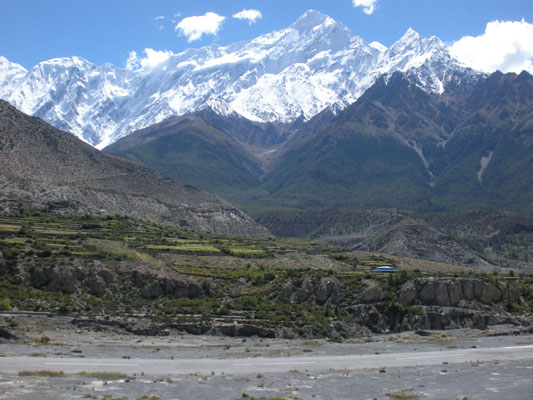
We soon arrived at Jomsom, which is the administrative centre of mustang district. It is a fairly relatively large place and it has the Nepal mountain warfare barracks and an airport from which you can fly to Pokhara. The view of Nilgiri from Jomsom was excellent. We stopped for lunch and then went to use the internet for the first time since Chame. We left Jomsom and began the walk to Marpha. By this time the Kali Gandaki wind had picked up and we used our Buddhist kata scarves to prevent us from breathing in the dust.
17.2. Nilgiri towers above the runway at Jomsom airport.
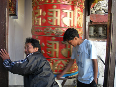
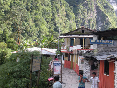
The afternoons walk was fairly short and after about an hour we had arrived at Marpha – ‘The delightful apple capital of Nepal’. It is also one of the cleanest villages in Nepal. We stayed at The Snow Leopard lodge, which is very nice and I had a large room with attached bathroom. Kanchha brought me an apple juice which was very refreshing after the walk in the sun. I then did my laundry in the bathroom sink and hung out on the balcony to dry. Afterwards Roj and I took a walk around Marpha. There were many shops selling Tibetan curios and the shopkeepers all came out to invite me in for ‘just a look’, but I’d bought enough Tibetan souvenirs in Kagbeni yesterday.
17.3. The clean streets of Marpha and the prayer wheel at Marpha gompa.
We eventually came to The Yak, which houses the safe water station and also a small bookshop. I refilled my bottle and bought Annapurna, by Maurice Herzog, the account of the first ascent of an 8000 m peak. At the end of the village we bumped into Kanchha at the Mona Lisa teahouse. We stopped there for tea and biscuits and also some dried buffalo meat. The three of us then went to visit the gompa at the top of the hill. In the evening I had a beer and played cards and tried the Marpha cider. It was quite nice but very different to Somerset scrumpy. Kanchha tried it but he didn’t like it.
Day 18: Marpha (2670 m) to Kalopani (2530 m)
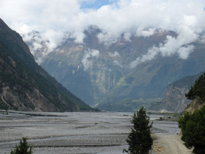
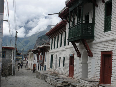
Today we continued our journey down the Kali Gandaki. Most of the day was cloudy and the arid landscape of the north was being replaced by alpine coniferous forests. The scenery was reminiscent of the region around Dharapani on the Marsyangdi side. We stopped for tea at Tukuche, formerly a major trading post on the Kali Gandaki. In the morning we had some decent views of Dhaulagiri to the west. After tea we went to the Tukuche distillery and met the woman who runs it. I tried a peach brandy and offered some to Kanchha but he didn’t like it. I tasted the apple brandy also and bought a small bottle ~1/4 litre for 60 rupees, very cheap. Kanchha bought a bottle of apricot brandy for even less, Nepali rates.
18.1. The view down the Kali Gandaki as Dhaulagiri peers over the hills.
18.2. The streets of Tukuche and the nearby gompa.
After tea the clouds had set in and there were no more mountain views. By the time we reached Larjung it had begun to rain. We had lunch in Larjung and the rain stopped for a bit. Shortly after lunch we arrived at Kalopani and checked into the lodge. In the evening Kanchha and I had some of the apricot brandy with some curried mutton.
Day 19: Kalopani (2530 m) to Tatopani (1190 m)
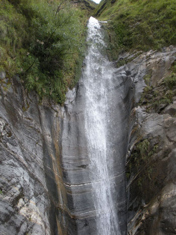
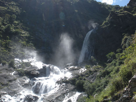
Last night it had rained a lot and this morning it was still very cloudy. We stopped for tea break at Ghasa. Soon afterwards we crossed the river to avoid some landslides on the west bank. Soon we left Mustang district and entered Myagdi district. This region is predominantly populated by Magar people. As we descended further we left the coniferous alpine region and entered once again into the sub-tropical hill lands with scenery reminiscent of that around Ngadi and Bahundanda on the Marsyangdi side.
19.1. Some impressive waterfalls on the way down to Tatopani.
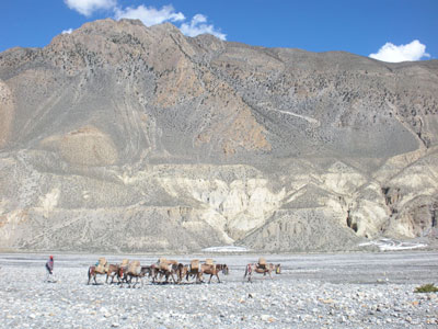
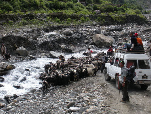
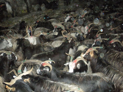
We stopped for lunch at the small village of Kopchepani. On the way down to Tatopani we came across a large herd of Chhangra (sheep/goat cross breed) that were being herded across a waterfall. They didn’t look keen on getting their feet wet and the herders were struggling to get them across. Behind was a jeep that was stuck waiting for the sheep to move. It was a Nepali style traffic jam and it eventually cleared and we all got across.
19.2. Nepal style traffic jam.
Soon after we came to Tatopani and at 17:00 we went to the hot springs which gives the town its name. It was relaxing but made me feel a bit dizzy as it was so warm, so I didn’t stay in for too long. Afterwards we got changed and went to a local restaurant where we had the local millet wine, known as rakshi and some curried mutton.
For dinner we came back to the lodge, The Trekker’s lodge, where I had chicken curry and a beer. Today is also the first day of Dasain. This is the festival where many sheep, pigs, goats, cockerel and buffalo are killed and meat is readily available. Many Nepali’s come back to their home villages for the duration of the festival and Kathmandu and Pokhara are rather quieter.
19.3. Arriving in Tatopani and the streets filled with Chhangra when we left the bar.